

New Wildfire Starts & Updates On Santa Fe National Forest … Lightning Started Fires Within Cuba, Española, Pecos Ranger Districts
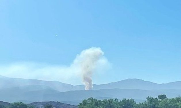
View of the Frijoles Fire sparked by lightning on Aug. 4, 2026. The blaze has consumed 200 acres in steep terrain 5 miles west of Sierra Mosca, 3 miles southeast of Cundiyo within the boundaries of the Pecos Wilderness Area. On scene are U.S. Forest Service – Engine 461, Santa Fe Hotshots, Smoke Jumpers and multiple aerial resources. Courtesy/USFS
SFNF News:
SANTA FE — Fire resources are actively responding to suppress eight fires that may have resulted from recent thunderstorms throughout northern New Mexico.
Safety: The health and safety of firefighters and the public are always the priority. Members of the public should avoid the fire areas. Drones pose a serious risk to firefighting and can cause air operations to cease. The public is reminded that “If you fly, we can’t!”
Española Ranger District
Frijoles Fire
Reported Date / Time: Aug. 4, 2026 / 6:57 p.m.
Cause: Lightning
Size: 200 acres
Containment: 0%
Location: Steep terrain 5 miles west of Sierra Mosca, 3 miles southeast of Cundiyo, NM. The fire is within the boundaries of the Pecos Wilderness Area.
Personnel: U.S. Forest Service – Engine 461, Santa Fe Hotshots. Smoke Jumpers and multiple aerial resources.
Strategy: Direct extinguishment.
Fire Behavior: High spread potential.
Fuels: Ponderosa Timber, dead & down.
Operations: Fire fighters have established UTV access to the northeast of the fire. The Santa Fe Hotshots will begin building fireline on the northeast corner working east along the northern flank of the fire. Smoke jumpers will begin constructing helispots so that more equipment can can access the fire area. Large air tankers and helicopters will continue dropping retardant and water.
Smoke: May be visible from Santa Fe, Cundiyo, Nambe, Chimayo, Pojoaque, and Espanola.
Cuba Ranger District
Lodin Fire
Reported Date / Time: Aug. 3, 2026 / 4:27 p.m. Reported by Cerro Pelado Lookout.
Cause: Lightning.
Size: 6 acres.
Containment: 20%.
Location: Heavily timbered Forest Service land, private lands, cabins, and inholdings are located within one-quarter mile of the Lodin Fire. 2 miles south of Jarosa and 4.5 miles west of Cerro Pelon.
Personnel: 24 Personnel from U.S. Forest Service – Engine 621 and UT 621. Multiple aviation resources.
Strategy: Direct extinguishment.
Fire Behavior: Moderate.
Fuels: Ponderosa Timber, dead and down.
Operations: On Aug. 5, access for engines was secured and initial handline around the fire was established raising containment to 20%. Today crews will improve line along the left and right flank of the fire, working along the interior edge of containment line to locate and extinguish lingering heat.
Smoke: May be visible from Cuba, La Cueva, and NM 126.
Spring Fire
Reported Date / Time: Aug. 3, 2026 / 5:23 p.m. Reported by Cerro Pelado Lookout.
Cause: Lightning.
Size: 1 acre.
Containment: 0%.
Location: Heavily timbered Forest Service land, private lands, cabins, and inholdings are located within one-half mile of the Spring Fire. 3 miles southeast of Jarosa and 3 miles west of Cerro Pelon. One mile east of Lodin Fire.
Personnel: U.S. Forest Service Wildland Fire Fighters and aviation resources.
Strategy: Direct extinguishment.
Fire Behavior: Low.
Fuels: Timber and grass.
Operation: Minimal heat was found yesterday. Crews will continue to secure line around the fire.
Smoke: May be visible from Cuba, La Cueva, and NM 126.
Pecos Ranger District
Glorieta Mesa Fire
Reported Date / Time: Aug. 4, 2026 / 5:19 p.m.
Cause: Lightning.
Size: 0.1 acres.
Containment: 0%.
Location: On the western side of Glorieta Mesa, 1.5 miles south of Glorieta and 1 mile east of I-25.
Personnel: U.S. Forest Service – Engine 641.
Strategy: Direct extinguishment.
Fire Behavior: Low spread potential.
Fuels: Pinyon-Juniper stands, Ponderosa Timber.
Operations: Resources have surrounded the singular lightning struck tree in hand line and are extinguishing spot fires.
Smoke: May be visible from Glorieta, Grasshopper Canyon, Valencia, and Canoncito.
Macho Canyon Fire
Reported Date / Time: Aug. 5, 2026 / 1:15p.m.
Cause: Lightning.
Size: 2 acres.
Containment: 0%.
Location: Two miles west of El Macho, south of Macho Creek.
Personnel: U.S. Forest Service – Unit 5-31.
Strategy: Direct extinguishment.
Fire Behavior: Low spread potential.
Fuels: Ponderosa, mixed conifer and oak brush.
Operations: Resources have completely initial fireline and are strengthening handline while monitoring for hot spots.
Smoke: May be visible from N.M. 63.
Windy Bridge Fire
Reported Date / Time: Aug. 5, 2026 / 4:03 p.m.
Cause: Lightning.
Size: 0.1 acres.
Containment: 0%.
Location: North west of Windy Bridge off N.M. 63.
Personnel: U.S. Forest Service – Engine 641.
Strategy: Direct extinguishment.
Fire Behavior: Low spread potential.
Fuels: Ponderosa Timber.
Operations: Yesterday helicopters performed bucket drops. Today a Type 6 engine was dispatched to the location to establish control lines.
Smoke: May be visible from N.M. 63.
Sierra Fire
Reported Date / Time: Aug. 5, 2026 / 2:15p.m.
Cause: Lightning.
Size: 0.1 acres.
Containment: 0%.
Location: Near N.M. 63 north Sawyer Canyon Road.
Personnel: U.S. Forest Service – Engine 641.
Strategy: Direct extinguishment.
Fire Behavior: Low spread potential.
Fuels: Ponderosa Timber.
Operations: Yesterday helicopters performed bucket drops. Today a Type 6 engine was dispatched to the location to establish control lines.
Smoke: May be visible from State Highway 63.
High Peak Fire
Reported Date / Time: Aug. 5, 2026 / 7:00 a.m.
Cause: Lightning.
Size: 0.1 acres.
Containment: 100%.
Location: Near Cow Creek east of N.M. 63.
Personnel: U.S. Forest Service – Engine 641.
Strategy: Direct extinguishment.
Fire Behavior: Contained.
Fuels: Ponderosa Timber.
Operations: The fire was declared contained at noon Aug. 5, 2026.
Smoke: May be visible from N.M. 63.
Weather for the Region (Aug. 6, 2026):
A moist monsoonal pattern will persist across northern New Mexico with mostly sunny skies and scattered afternoon showers and thunderstorms from Cuba through Santa Fe to Glorieta. High temperatures will range from the upper 70s to mid-80s, with minimum relative humidity between 20–35 percent and good overnight recoveries of 60–90 percent. Terrain-driven winds of 5–15 mph will become erratic and gusty near thunderstorms, with outflow winds potentially exceeding 35–45 mph. Lightning, brief heavy rainfall, localized flooding, and sudden wind shifts will be the primary weather concerns for fire operations.
Closures:
There are no area closures currently. Visitors are encouraged to avoid the vicinity of both fires and use caution when traveling near firefighting operations.
Fire Information:
facebook.com/santafeNF/ x.com/SantafeNF/ nmfireinfo.com.
About the Forest Service:
The Forest Service has brought people and communities together to answer the call of conservation for more than 100 years. Grounded in world-class science and technology — and rooted in communities — the Forest Service connects people to nature and recreation opportunities. The agency manages 193 million acres of public land, supports the nation’s forest industry and energy needs, and operates the largest and most respected wildland fire and forestry research organizations in the world. By providing assistance to state and private landowners and working with tribes and other partners, the Forest Service also helps steward an additional 900 million forested acres within the U.S.