

Brazilian inland waterways gain focus in PNL 2050 as multimodal logistics link
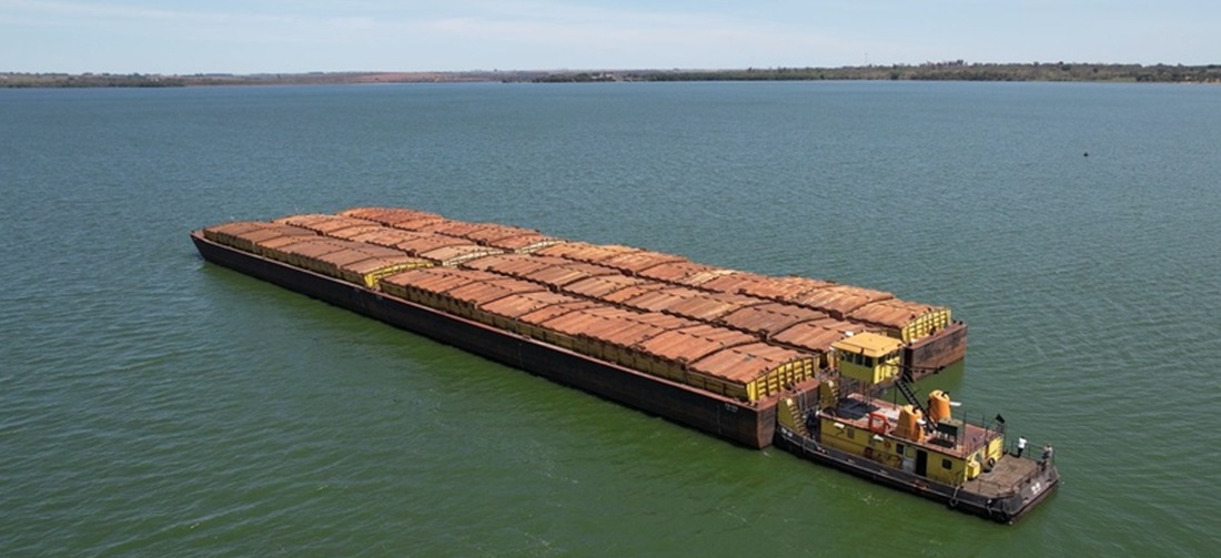
Brazilian inland waterways are at the center of a logistics integration strategy designed to connect rivers, ports, terminals, highways and railways into corridors capable of reducing bottlenecks and expanding cargo transport options across the country.
The approach is part of Brazil’s National Logistics Plan 2050, known as PNL 2050, which treats inland navigation not as a stand-alone transport mode, but as one stage in broader logistics chains.
The logic is straightforward: cargo moving by waterway usually begins its journey at a farm, industrial plant, mining area or distribution center, reaches terminals by truck or rail, and after the river leg may continue by land again or be transferred to oceangoing vessels.
For logistics agents, traders and port operators, this design is relevant because the performance of a waterway depends directly on the quality of land access, terminal capacity and the efficiency of the ports connected to the corridor. Even when the navigable stretch itself is in good condition, the operation can lose competitiveness if there are bottlenecks in storage, transshipment, highways, railways or port infrastructure.
Northern Arc concentrates strategic projects
In the Northern Arc, one of Brazil’s main outlets for grain and cargo flows from the Center-West and the Amazon region, PNL 2050 organizes investment around corridors that combine waterways, railways, highways, terminals and port complexes.
On the rail-waterway axis, the plan foresees improvements to the Tapajós waterway, especially along the stretch between Itaituba and Santarém, as well as interventions on the Amazon River waterway and the Breves Straits. These projects are linked to the implementation of Ferrogrão and the expansion of port complexes in Pará, Amapá and Amazonas.
On the road-waterway axis, the same navigable corridors are connected to expansions along BR-163 and BR-230 and to port facilities in the region. For the market, that combination is decisive because a significant part of the Northern Arc’s competitiveness depends on the ability to integrate agricultural production, land transport, river transshipment and maritime shipment at lower cost and with greater predictability.
By grouping these projects within the same corridor, the plan makes it possible to view the full cargo route: arrival by land, transfer to vessels, river transport and connection to ports capable of carrying the journey forward to domestic or international markets.
Amazon region requires integrated logistics
The same approach appears in the Amazon Integration axis. Federal planning brings together improvements to the Amazon, Madeira, Juruá, Solimões, Negro, Branco, Mamoré and Guaporé river waterways, as well as the Breves Straits. These stretches are linked to highways such as BR-319, BR-364, BR-174, BR-429 and BR-156, along with ports and terminals across northern Brazil.
In the Amazon, logistics integration also plays a role in regional supply. Waterways are essential for moving goods, inputs and services to cities where land infrastructure is limited. PNL 2050 itself recognizes that in parts of the North, waterways and airfields are the main — and in some cases the only — transport and mobility infrastructure available.
For foreign trade, however, the central point is different: the Amazon region is gaining importance as an export corridor for commodities, industrial cargo and products tied to supply chains in the North and Center-West. In this context, the efficiency of Brazilian inland waterways will increasingly depend on coordination with transshipment terminals, seaports, road access and future rail links.
Cabotage also depends on access infrastructure
The plan also includes maritime corridors. On the cabotage route between southern Brazil and Manaus, for example, PNL 2050 considers port facilities along the coast, land connections and river stretches providing access to the Amazonas state capital.
This is especially relevant for shippers and logistics operators because it shows that cabotage does not depend only on the availability of vessels. Cargo must reach the port of origin, be loaded, move along the coast, access a river leg when necessary and, after unloading, be distributed to its final destination.
In practice, any failure in one of these links can raise costs, extend delivery times and reduce the reliability of the operation. For that reason, integration among waterways, ports, highways and railways is likely to be decisive in expanding the use of navigation as a competitive logistics alternative in Brazil.
Planning aims to reduce bottlenecks
The message of PNL 2050 is that Brazil’s logistics bottlenecks will not be solved only through isolated works on rivers, ports or roads. The challenge is to make different transport modes function as a network, with coordinated investments guided by strategic cargo flows.
For traders, carriers, terminals and port operators, this vision may influence long-term decisions on warehouse location, transport contracts, export routes and the choice of logistics corridors.
If implemented with coordination between government and the private sector, the strategy could strengthen the competitiveness of corridors such as the Northern Arc, improve the Amazon region’s connection with national and international markets, and expand alternatives to road transport on long-distance routes.
Source: MPOR