

A trip down the road that will determine the fate of the Amazon
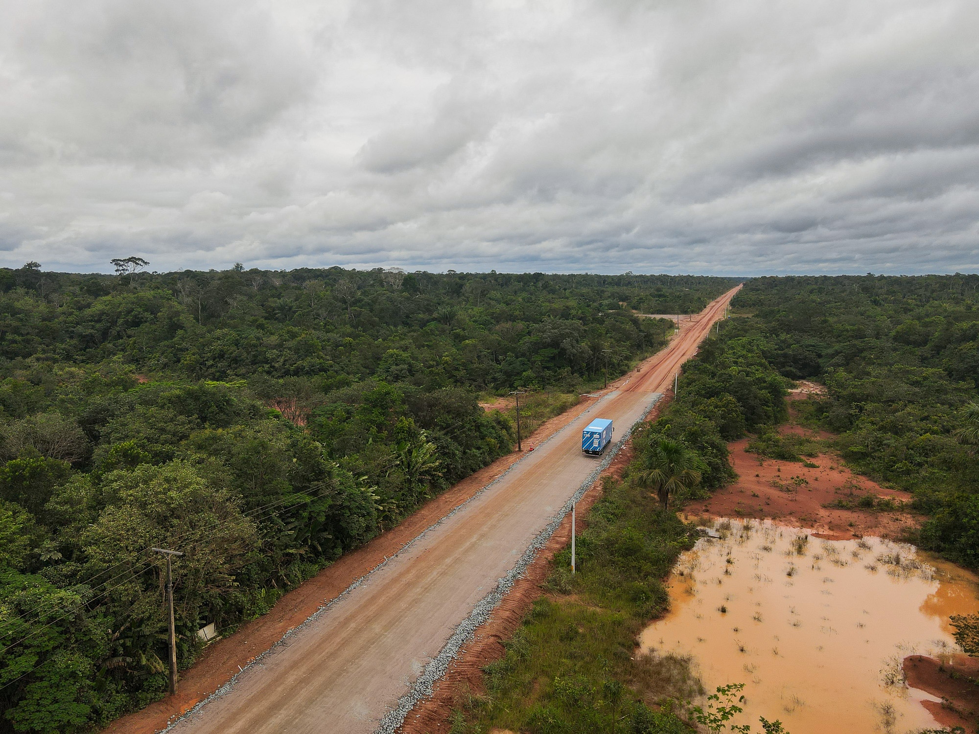
For much of his career, Carlos Santos’ job involved being stranded in the middle of the Amazon. Santos is a truck driver on the BR-319, a hazardous dirt highway in Brazil that cuts through a critical part of the rainforest. “You knew when you were going in,” he said of the road. “But you never knew when you’d come out the other side.”
It once took Santos 22 days to cross the 540-mile route. An unexpected rain pounded the highway during the dry season, leaving large pools of mud that mired convoys of trucks. “It’s a survival test in the jungle,” he said. “Time moves slowly. You have to ration food and water.” At night, Santos would hang a hammock in his truck cabin and watch as jaguars, tapirs, and snakes crossed the road in front of him. For weeks, he dug vehicles out of ditches, bathed in nearby rivers, and waited for heavy machinery to pull rigs from the mud one by one.
When he finally got home, Santos rested for a few days and then returned for another haul down the 319. “I went back because I enjoy it,” he said. “It’s one hell of a challenge.”
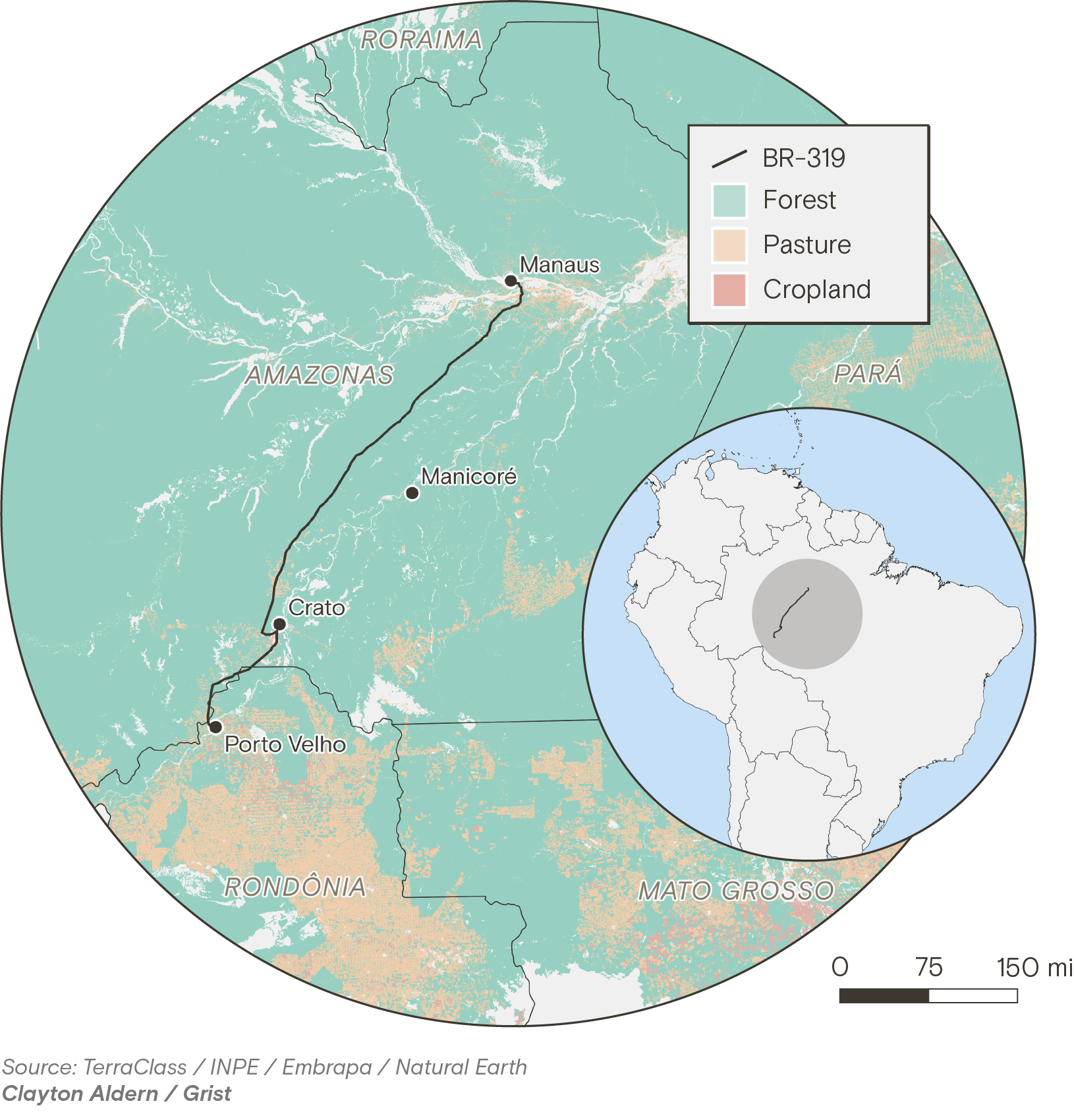
But there’s another reason such conditions are endured aside from a penchant for adventure. The BR-319 is the only road connecting the state of Amazonas, home to 4.2 million people and twice the size of Texas, to the rest of Brazil. Now, after decades of court battles and challenges by environmental groups and regulators, sections of the highway are being asphalted, and plans to pave the entire route are moving forward.
Asphalting the 319 is a long-held demand of many in the region, who feel their isolation hinders economic development. “Why should we be forgotten?” Santos asked. “Why doesn’t the state of Amazonas have the right to be connected to the rest of the country?”
But the decision isn’t so straightforward. Scientists warn that paving the road will connect previously inaccessible regions of the Amazon to its most under-pressure areas, leading to a deforestation boom with dire consequences for the global climate. The biome currently holds an estimated 150 to 200 billion tons of carbon in its plants and soils, helping to offset greenhouse gas emissions from activities like burning fossil fuels. When the forest is cleared and burned, that stored carbon is released back into the atmosphere, fueling climate change. Indigenous groups that live in the area also say the project poses an existential threat to their communities.
This May, before the paving went into full swing, I joined Santos on his route to observe how the 319 and the forest it traverses are already changing. We met at 3 a.m. at a distribution center on the outskirts of Manaus, the capital of Amazonas and home to over 2 million people. Despite its isolation, Manaus is a major manufacturing hub, the legacy of tax incentives that have attracted industry since the 1960s. The vast majority of goods currently enter and leave the city by boat or by air. Proponents of asphalting the 319 argue this dependence raises costs, lengthens delivery times, and leaves the region vulnerable to river-navigation interruptions brought on by severe droughts, which have become more common.
Santos was born and raised in Manaus and has been driving a truck since he was 18 years old. “I was never a fan of being locked in a room in front of a computer,” he said. Now 45, he is affable with an easy smile. His belly comes close to touching the steering wheel, and his trimmed salt-and-pepper beard matches the remaining hair on the sides of his head. A long career driving the potholed roads of Amazonas has left him with a bad back.
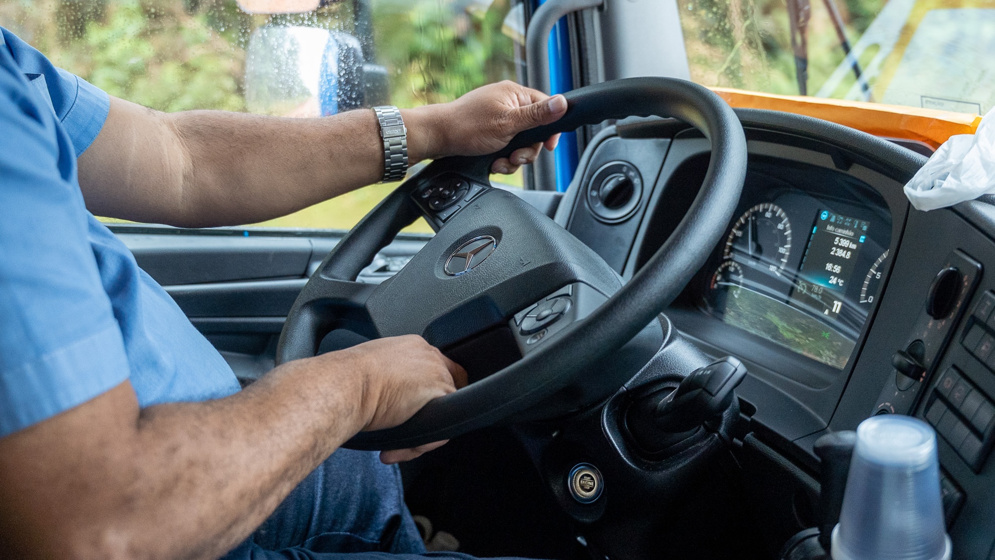
We pulled out of the distribution center in an immaculate bright blue semi-truck, smaller and more nimble than some of the larger rigs that are regularly seen stranded or capsized amid the mud of the 319. The truck belonged to Bemol, a leading retailer in the Amazon region, and carried large kitchen appliances, furniture, and medicine. Our destination was Porto Velho, the capital of Rondônia, which sits at the other end of the highway.
Santos has been driving on the 319 since 2015, when it reopened after decades of disrepair. Back then, he said, mud pools would stretch for dozens of yards during the rainy season, and potholes were the size of small craters. He was recounting this as we crossed the Rio Negro on a ferry, with dozens of other vehicles. The sun began to rise as we passed the famous meeting of the waters, where the dark, Coca-Cola-colored Rio Negro meets the murky brown Solimões, and the two rivers flow side by side without mixing. An hour later we were off the ferry and onto the highway. It would be a two-day trip with an overnight stop, but that was not guaranteed. The speed of travel on the 319 is highly dependent on the conditions of the road on any given day.
“You never know what to expect,” Santos told me.
In many ways, the history of deforestation in the Amazon is a history of road-building.
In the 1970s, Brazil’s military dictatorship pursued an aggressive policy of constructing roads and encouraging settlement in the Amazon region. Since then, an area roughly the size of Spain has been deforested — 94 percent of which sits within 3 miles of a road. Often the mere possibility that a road will be built or paved is enough to increase deforestation in a given area.
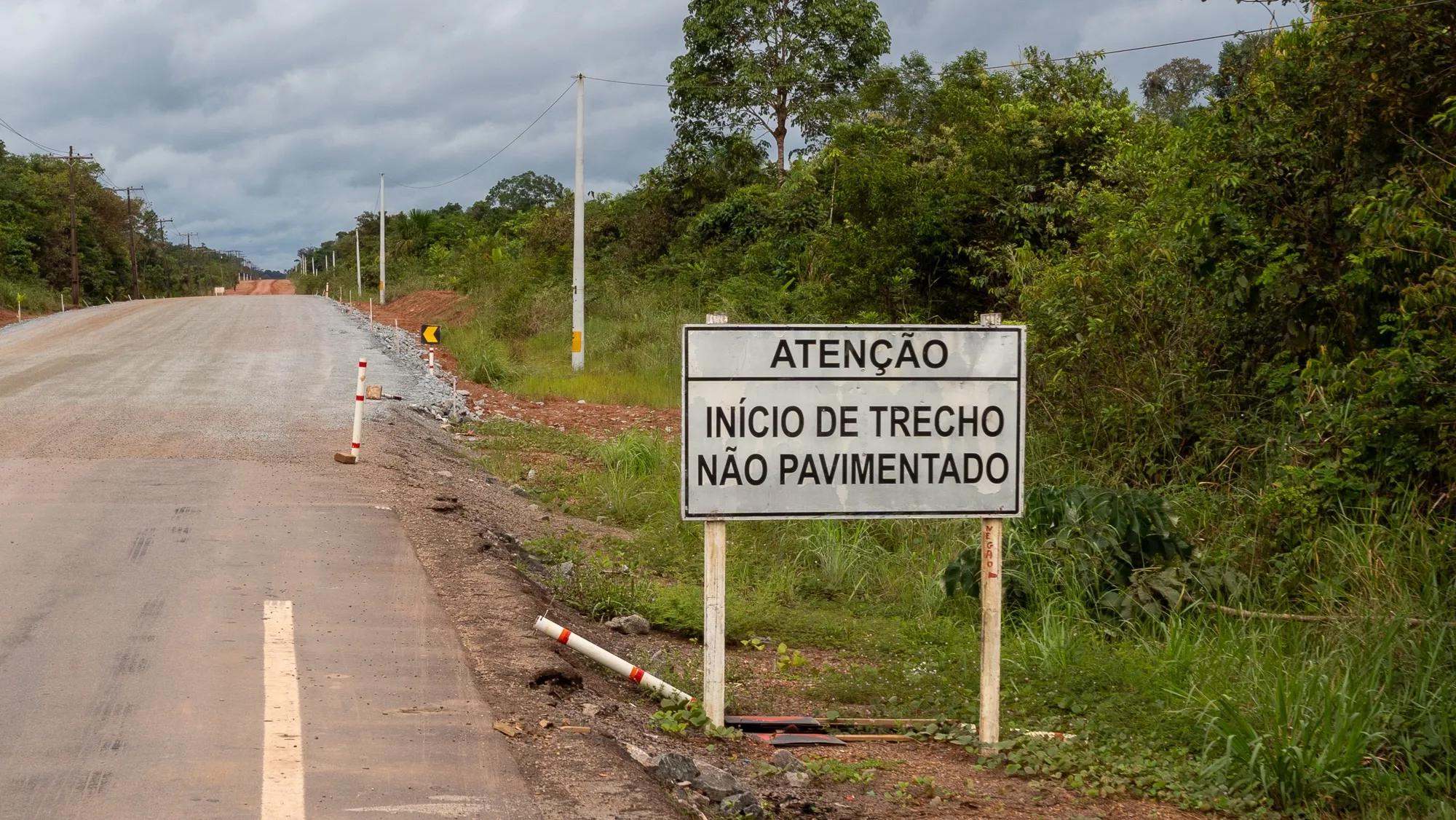
The BR-319 was fully paved when it opened in 1976, but maintaining it proved too costly. It runs through a low-lying part of the forest and over the years, the grinding conditions of the rainy and dry seasons eroded the asphalt. Bus companies ceased service along the route, and businesses stopped using it to ship goods. The trees closed in on the highway and by 1988 it was virtually impassable, with only the ends still covered with asphalt.
For years it was left to the forest, used only by the handful of communities that still lived along its route and the occasional adventurer passing through. The trees blocked the sky for long sections of the road, and the wood bridges rotted away. In 2015, federal regulators issued a license for the cleanup and maintenance of the roadway, though not its repaving. Crews worked to clear the trees and repair the more than 50 bridges that run along the road. Conditions remained precarious, but traffic returned.
When Jair Bolsonaro was elected president in 2018, he gutted environmental regulations and announced he would pave the BR-319 once again. A far-right former army captain, Bolsonaro had campaigned on a platform friendly to loggers, miners, and agribusiness. The promise alone drove a 122 percent rise in deforestation in the area surrounding the highway between 2020 and 2022, greater than the already high deforestation rate for the Amazon as a whole during the same period.
Brazil’s federal courts blocked the project due to inconsistencies in the environmental licensing process, but in 2025, years after Bolsonaro had left office, Brazil’s pro-agribusiness Congress passed a law that said work on existing roads could bypass licensing altogether. President Luiz Inácio Lula da Silva, or Lula, tried to veto parts of the bill but was overruled by Congress. In May, the government opened bidding for paving contracts. “By the end of June,” George Santoro, the Minister of Transportation, announced, “the entire BR-319 will be under construction.”
After the ferry, the BR-319 continues on potholed asphalt for 120 miles, the final remnants of the original 1970s road. As we drove through the district of Careiro, the first on the 319 after Manaus, the landscape varied between forest and pasture, with modest, scattered homes on the side of the road. “Houses used to be a rare sight,” said Santos. “You’d see one here and another way off in the distance. Not anymore.”
It’s typical of a region in the early stages of deforestation. First, speculators and loggers clear public land. Once the timber is extracted, ranchers move in. They might live on the land themselves, but often they’ll hire someone to live there for them and tend the livestock. The ultimate goal is to petition the government for a formal land title which, if granted, can be resold once the road is fully paved and the land worth far more. The process of land regularization in Brazil is slow, bureaucratic, and rife with irregularities. Occupation is often a first step towards legal recognition, even when the initial clearing was illegal.
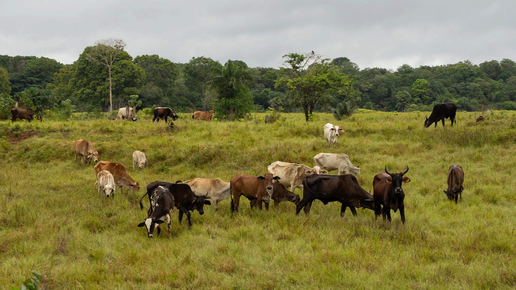
For three months in 2023, Manaus was shrouded in a thick cloud of smoke, ranking it among the cities with the worst air quality in the world. The governor of Amazonas at the time blamed the crisis on forest fires in the neighboring state of Pará. Research using satellite imagery and atmospheric data has since shown that while some of the smoke was indeed coming from Pará, much of it originated from forest-clearing blazes in districts at the start of the BR-319, like Careiro.
As the old asphalt continues, the pastures become less frequent and the landscape progressively more wild. Then, all of a sudden, the asphalt turns into a reddish, iron-rich clay. It’s a surface that is rock-hard when dry and extremely slippery when wet. The rainy season brings mud and a slickness that causes trucks to glide out of control. The dry season brings clouds of dust that reduce visibility to just a few yards. This constant wetting and drying causes the dirt to form small ridges that drivers have come to call “cow ribs.” They rattle trucks like never-ending rumble strips.
Compared to what the highway was like in the recent past, this is a minor nuisance. “For the veterans around here, the road is a cakewalk now,” Santos said. The BR-319 may not be paved yet, but maintenance on the route has intensified in the past few years.
We encountered a road crew just a few miles after hitting dirt. To keep the highway passable, crews work daily on different sections, flattening uneven terrain, packing the ground, and adding gravel. Areas that easily flooded just a few years ago have been raised, bridges repaired or rebuilt entirely. (Environmentalists claim that much of this work goes beyond the maintenance license that was issued in 2015.) The road is still mostly used by trucks, but new companies can now be seen on the route, mostly transporting consumer goods, some coming from as far as São Paulo, 2,400 miles away.
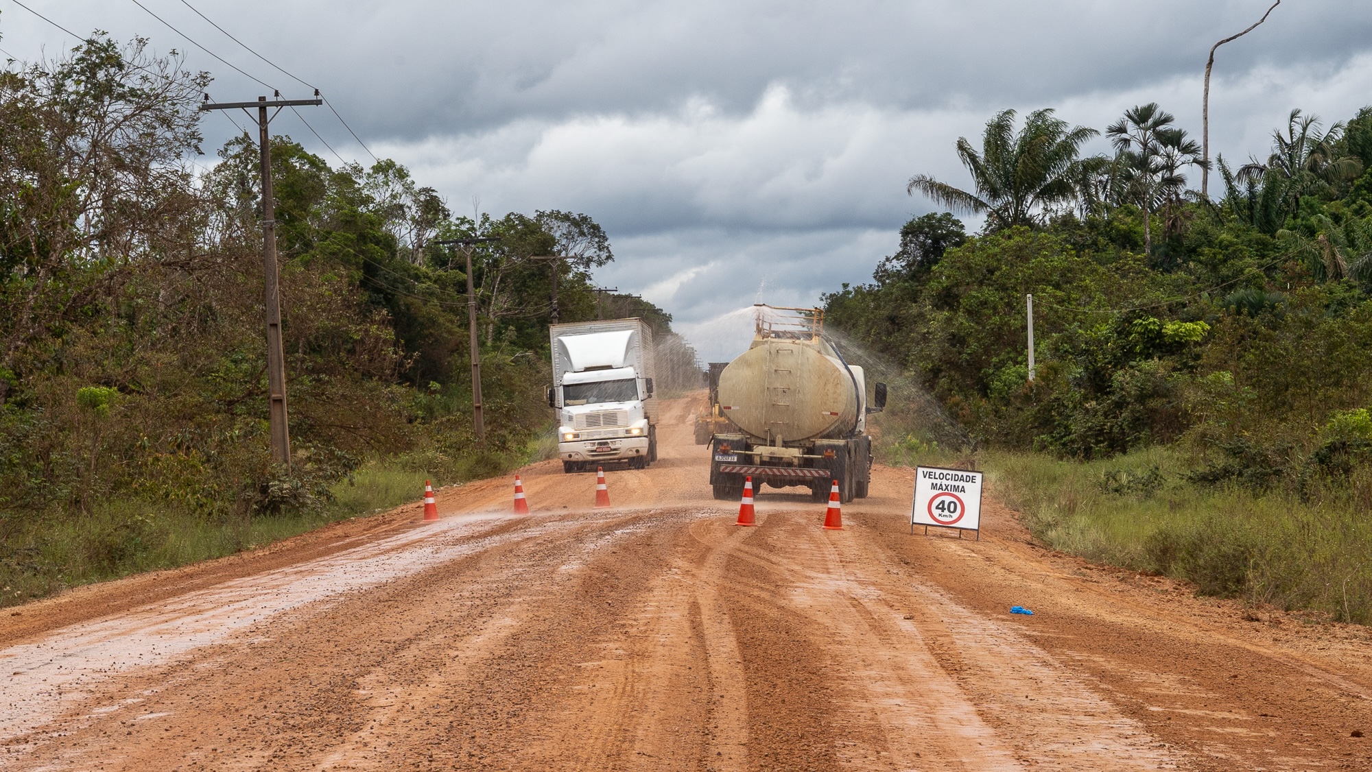
Traveling the 319 with Santos means listening to an unbroken catalogue of accidents he’s witnessed. A truck that rolled into a ravine here, dropping brand new washing machines into the river. Another that tumbled over there, spilling gallons of milk onto the road. Even today, it is not uncommon for Santos to encounter a capsized truck, sometimes more than one in a single journey.
As we ventured deeper down the highway, lush forest occupied both sides of the road. “It’s every shade of green you could think of,” Santos remarked. He had a point. One hectare of Brazilian Amazon holds more species of trees than all of the continental United States and Canada combined.
About eight hours in, we reached the settlement of Iguapó-Açu. The town is home to some 75 families who live in stilt houses with tin roofs. It serves as a final rest stop for truck drivers before they face the BR-319’s middle stretch, where it cuts through 250 miles of dense forest with virtually nothing else around. Residents of Iguapó-Açu live on subsistence farming, fishing, and by operating a sluggish barge that drivers must take across a narrow river to continue on their way down the 319.
While waiting for the barge, I spoke to residents who were eating freshly-caught fish stew on the porch of one of the houses. Raimunda de Sá Assunção, 53, moved to the town as a child and still remembers when the road was paved. She also remembers the years when the road fell into disrepair, many families left, and the drive to the nearest hospital could take days. Now the drive can take as little as two hours. She remains skeptical whether the road will ultimately be paved. “My hair’s turned white, and nothing’s happened. All they do is plug holes,” she said. “I’ll believe it when I see it.”
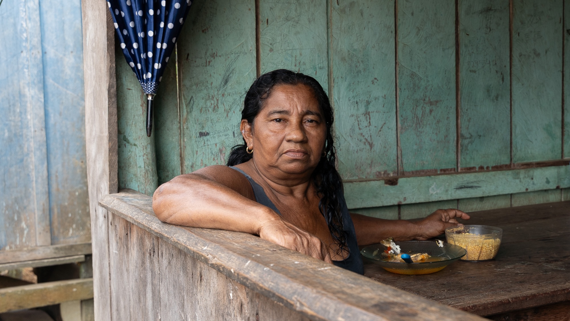
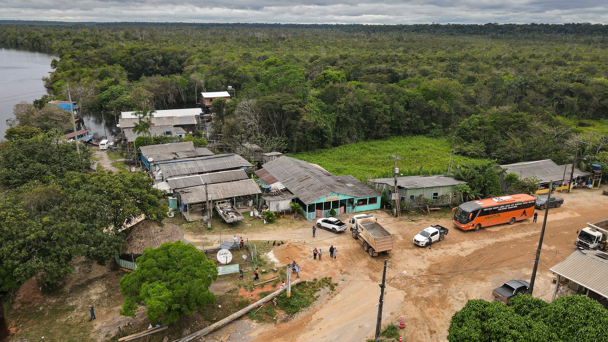
Raimunda de Sá Assunção is a long-time resident of Iguapó-Açu. Joaquim Salles
A spot just a few miles north of Iguapó-Açu was the site of a presidential photo-op in late May. As Lula posed with a road crew working on the 319, he painted a rosy picture of the future. “We will set an example of how to build a road,” he said, adding that the paved highway would be “the most beautiful and most preserved road in the world.”
Lula was elected in 2022 by a broad anti-Bolsonaro coalition. Among those who buoyed him to victory was Marina Silva, the politician and environmental activist who is one of the Amazon’s most respected defenders. To get her support, Lula put the environment at the forefront of his campaign, pledging to put Brazil on a road to end deforestation by 2030.
He’s had mixed results. Deforestation rates are significantly down from the Bolsonaro years, but the government has had little success in stopping a barrage of anti-environment legislation coming from Congress, including the licensing reform that cleared the path for the paving of the 319. Now running for office again, Lula has thrown his support behind the paving, knowing that not doing so will cost him votes in the Amazon region. Silva has since left the Lula government to run for Senate in the upcoming elections. She has long been seen by many in the Amazon as an obstacle to paving the BR-319. In reality, she has never opposed the road outright, only insisted that it proceed with adequate environmental safeguards in place.
The week of the photo-op, in closed meetings with environmental groups, the government said a portion of the highway’s R$1.5 billion ($300 million) construction budget would also go towards an environmental governance plan. It would involve the creation of protected areas, wildlife bridges, and a ramp-up of environmental monitoring in a 60-mile buffer zone along the entire route. The main criticism from environmental groups is that these measures should have been implemented before any paving takes place. Instead, they are still in the discussion stage while the BR-319 is actively being asphalted.
“The plan being drawn up needs to be translated into documents with feasible, credible targets,” said Suely Araújo, Public Policy Coordinator at Observatório do Clima, a coalition of Brazilian civil society organizations focused on climate. “You need structural measures that are actually implemented. Not just promised.”
On September 8, Lula announced the formal creation of four protected areas around the BR-319, encompassing 2,600 square miles, well below the nearly 14,000 square miles the government had promised in closed meetings months earlier.
“On one side were people who thought it was off-limits to undertake a project on a road that had already been built, connecting two state capitals,” Lula said in a speech during the announcement ceremony. “On the other were people who thought we should do it haphazardly, without any environmental-preservation criteria, without properly demarcating the relevant areas, turning it into a way for a few people to get rich by buying and selling land. We insisted that it was possible … We found a way to demarcate whatever needed to be demarcated.”
As it stands, most of the land around the BR-319 remains undesignated public land, the most attractive target for land-grabbers. It’s unclear if the government plans to announce additional conservation units. There is speculation that it might do so next year if Lula wins reelection in October. Polls show him neck-and-neck with Senator Flávio Bolsonaro, the son of former president Jair Bolsonaro.
While research shows that giving an area protected status is a powerful deterrent to deforestation, it is by no means a silver bullet. “It’s far from enough. Many conservation units exist only on paper.” said Araújo. “The plan for the region hasn’t been formalized yet. What we’ve seen is a Power Point presentation.”
The whole notion of whether the Brazilian state is capable of closely monitoring an area as large as the one impacted by the BR-319 is up for debate. Araújo told me there is no historical precedent for it in Brazil. IBAMA, the main agency responsible for environmental enforcement, is chronically understaffed. The area around the BR-319 almost entirely lacks state presence. Authorities that attempt to enforce environmental regulations in the region are often met with hostility. There are no police checkpoints and no bases for any of Brazil’s environmental monitoring agencies along the 319, though the government had pledged to establish them in the future.
The main risk is what experts call the “fishbone phenomenon,” a pattern seen from above in many parts of the Amazon. Highways serve as a main corridor from which illegal side roads opened by loggers, land-grabbers, and wildcat miners branch out. The highways are the spine of the fish and the side roads are the ribs. It is from these unauthorized roads that much illicit activity takes place.
The BR-319 is only in the early stages of this process, which picked up when the road reopened in 2015 and intensified during the Bolsonaro years, but it already has more miles of side roads than the length of the highway itself. Follow one of those through satellite images and inevitably you’ll find large, recently cleared areas in the middle of the rainforest.
Phillip Fearnside, a biologist at the National Institute of Amazonian Research, or INPA, has studied the region for decades. “You have a huge area that could be deforested very quickly,” he said.
Researchers have used complex modeling to simulate how the paving of the BR-319 and the proliferation of side roads — both legal and illegal — will impact the forest. One study, led by Britaldo Soares-Filho of the Federal University of Minas Gerais, found that if the road is asphalted, the resulting deforestation in the region would emit 8 billion tons of carbon dioxide by 2050, four times more than if the highway remained unpaved but maintained. A separate study projected that deforestation will be 60 percent greater by 2100 under a paved scenario.
Fearnside argues the impact would extend far beyond the 60-mile buffer zone that the government has pledged to monitor because the asphalt would connect the mostly untouched central Amazon — “the last big stretch of forest,” as he described it — to deforestation hotspots in the south. “It would be enough to push climate past the tipping point where warming gets out of control,” he said.
The threat is not only theoretical or in the future. Indigenous communities in the highway’s reach are already feeling the consequences. There have been several reports of illegal side roads encroaching into Indigenous territory. The Mura people in the region of Lago Capanã Grande have been under growing threat from land-grabbers since 2020, as conditions on the 319 improved and traffic increased. There is evidence that the toxic chemical 2,4-D, one of the main components of Agent Orange, was used to deforest land the Mura use to harvest Brazil nut, a key food source in the region. The waste was then dumped into rivers relied on by the community and made 20 people ill.
In total, there are 69 Indigenous territories in the region impacted by the BR-319, including some groups living in voluntary isolation. Together, these territories are inhabited by at least 13 different ethnicities comprising over 18,000 people. Although Brazilian law requires that Indigenous groups be consulted on large infrastructure projects that could impact them, there is no evidence this has happened in this case.
“Consultation must happen before any decision is made, with real dialogue and the possibility of influence, including the right to say ‘no.’ What is happening is the opposite,” Mariazinha Baré told the Brazilian website Nexo. Baré is a coordinator at APIAN, a coalition of Indigenous groups from Amazonas. “BR-319 is not just infrastructure; it is an instrument of death that threatens the existence of Indigenous peoples and weakens the Amazon,” she said.
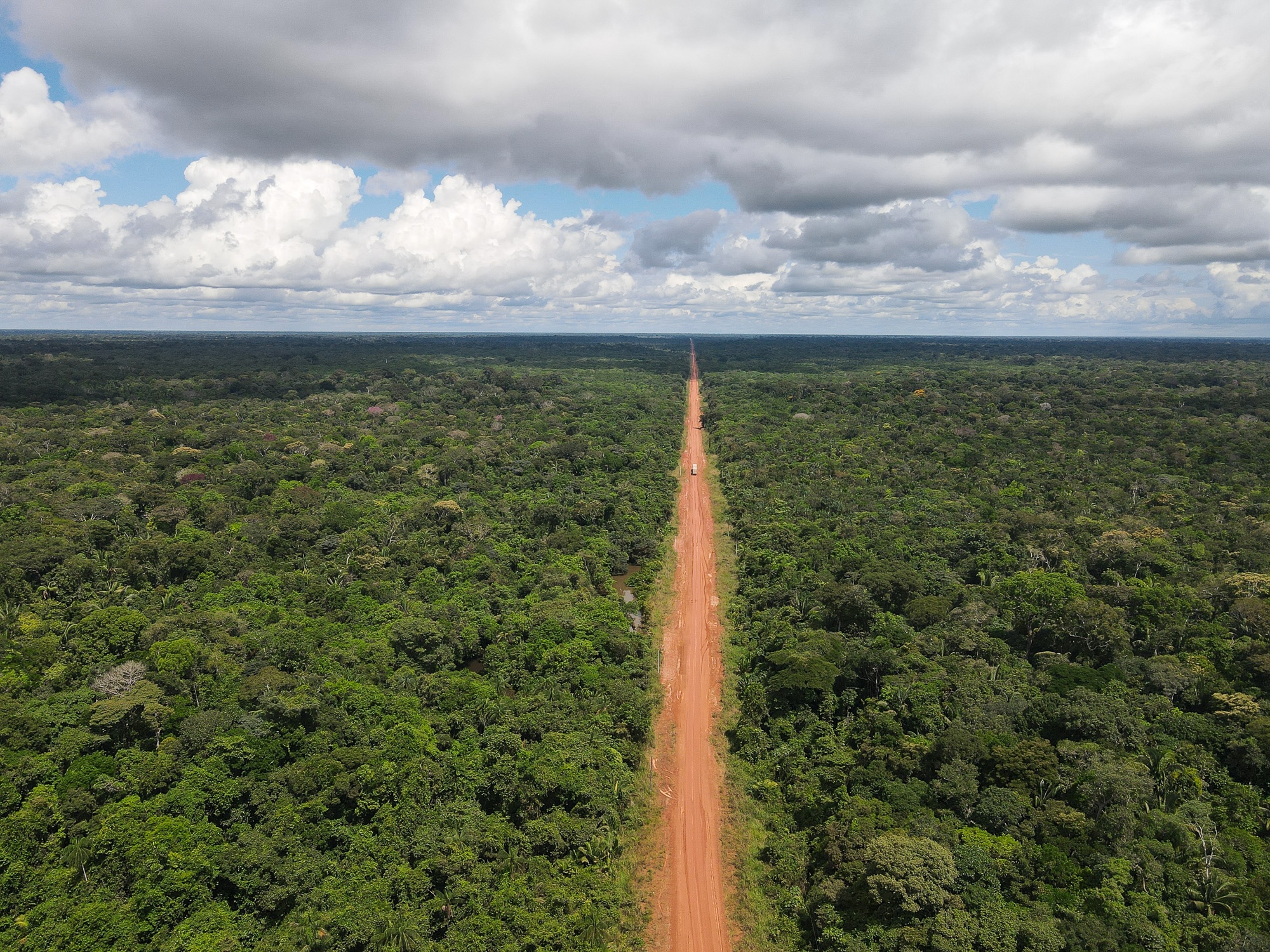
After Iguapó-Açu, the 319 enters its wildest section. We stopped so I could get an aerial view using a drone. At 400 feet, nothing but thick, impregnable forest stretched to the horizon in every direction, except for the distinct red gash of the highway.
Since there is no cell service, truckers going in opposite directions often stop to swap notes on road conditions and weather. It wasn’t long after we started driving again that a passing trucker warned of rain ahead.
It began as a soft patter but quickly turned torrential. “While it’s raining, it’s best to push on,” Santos said. It’s the hours after the downpour, when the ground is drying but still slick, that are the most dangerous for drivers. It was getting late, and we still had 100 miles to go before reaching the town of Realidade, where we’d spend the night.
Large puddles began pooling across the road, and the ground turned to sludge. A few miles later, we encountered a stranded truck, a flatbed carrying generators that had drifted to the road’s soft shoulder and listed sharply to one side. “Welcome to the BR-319!” Santos laughed.
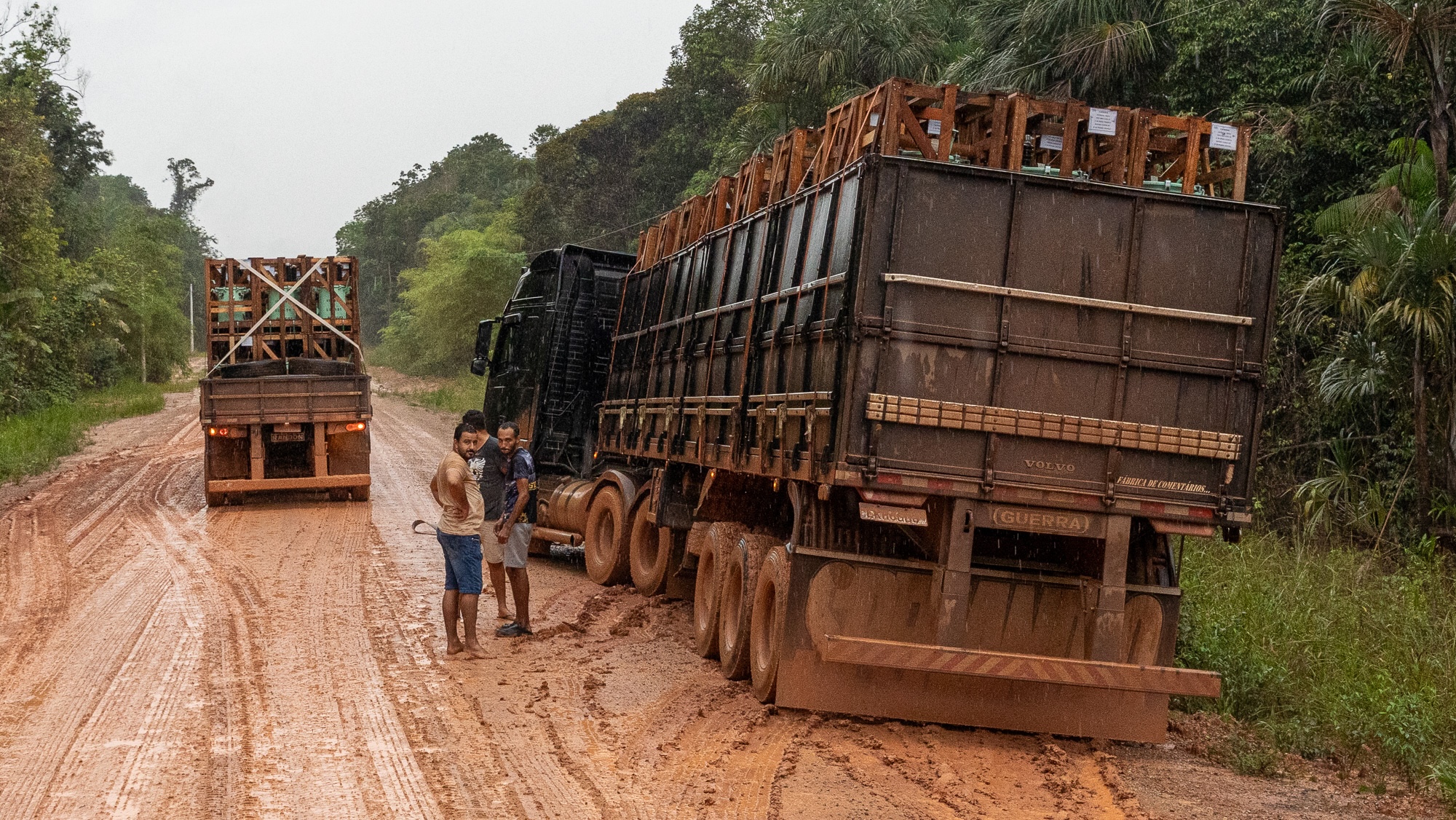
The sun set and soon we could only see what was illuminated by the headlights. The rain continued relentlessly. At times our speed was reduced to just 5 miles per hour. Santos pressed on, passing other stranded trucks and crossing rickety wooden bridges that creaked under the wheels. Many hours later, we came to a town that appeared seemingly out of nowhere. The muddy streets were deserted and dark as we pulled into a bright orange motel called La Kazita.
It was 11 p.m., 20 hours after our departure from Manaus.
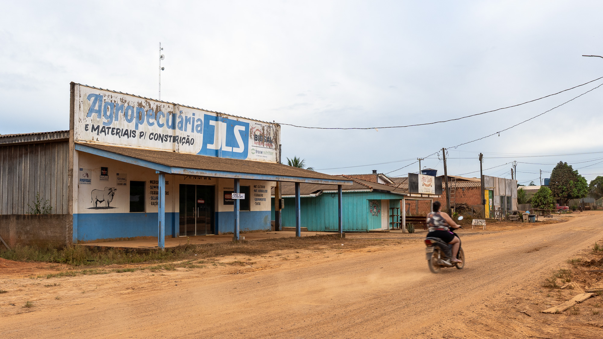
The largest settlement on the unpaved part of the 319, Realidade is a dusty outpost typical of Amazonian boom towns. Its population has swelled from just 800 people in 2010 to 7,000 today. The town lives and dies by the highway.
Many of its original residents were workers who built the road in the 1970s. When the route closed in 1988, Realidade became a virtual ghost town. Landless farmers from out of state arrived in the region in 2004 and were granted settlement rights under a federal land-reform program. Since then, a steady stream of land-grabbers, loggers, and cattle-ranchers have poured in.
Exploring Realidade, the impression is that the people arrived before the government did. The town has no police station and only a small health post, but numerous cattle-ranching supply stores. The dynamic has been the same throughout the modern history of the Amazonian frontier: People come in search of land and the riches of the forest; the state then scrambles to catch up with basic services and the rule of law.
At La Kazita, Santos and I were eating a breakfast of plain bread when the manager began telling us how two nights before he had been paid R$600 ($115) to drive some logging workers to Humaitá, a mining town southeast of the 319. They had just come out of the forest after weeks of work felling trees. Flush with cash, they wanted to party.
Data from Simex, a system that uses satellite images to monitor logging, show that 16 square miles of land were illegally logged between 2021 and 2024 in the municipality that includes Realidade.
“All the money flowing through the region is rooted in illegal logging and land grabbing,” Lucas Ferrante, a researcher at the University of São Paulo who has studied the area extensively, told me.
The scenery around Realidade is a far cry from the lush forest I had driven through the day before. Illegal side roads abound, sawmills dot the side of the highway, and native forest is interrupted by swaths of pasture. I stopped by one of the largest ranches in the region.
Eliane Jesus Pereira, 33, lives in a ramshackle wooden house at the edge of an expansive pasture. She sells cheese made out of buffalo milk while her husband tends to the cattle. The couple moved to the farm from Realidade in 2021 when her husband was hired as a ranch hand. The owner of the land lives in Manaus. Since she has been living on the farm, she’s seen a marked improvement on the road. “Sometimes my daughter couldn’t go to school because the bus got stuck in the mud,” she said. “Now it’s better.”
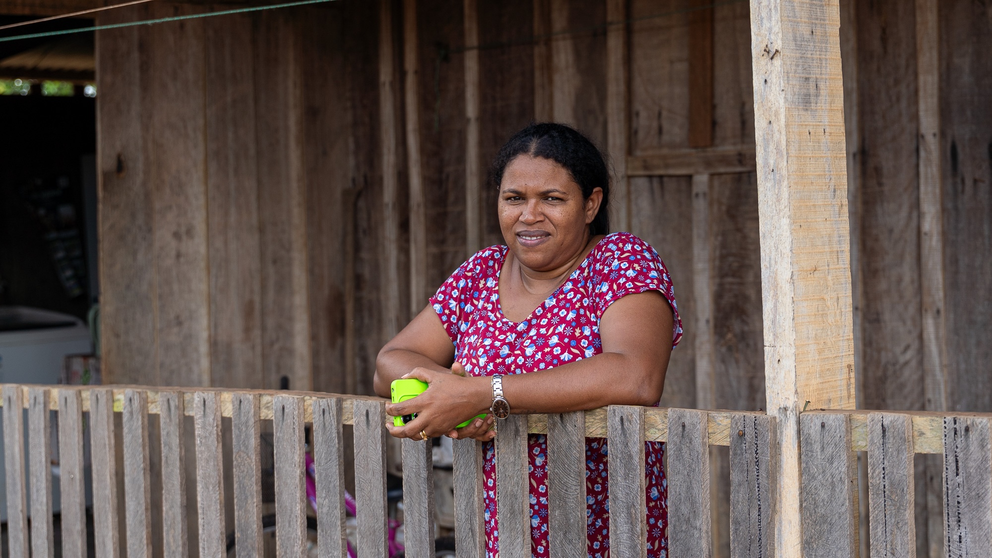
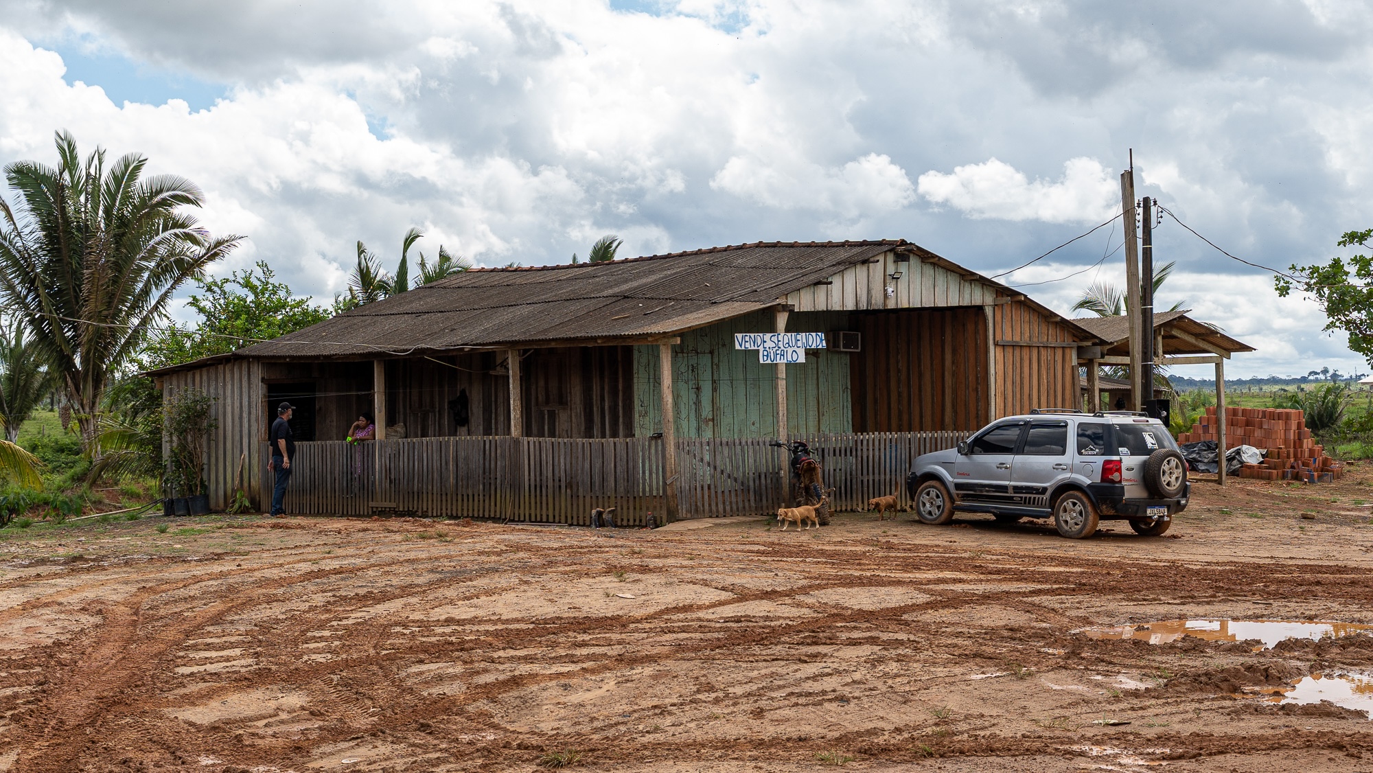
Eliane Jesus Pereira lives on a ranch a few miles north of Realidade. Joaquim Salles
It’s consensus among the scientific community that paving the BR-319 without environmental safeguards will lead to drastic consequences. Realidade might well be a vision of the future of the entire highway. Beyond the immediate impacts, studies suggest that the deforestation the asphalt could trigger may disrupt key hydrological cycles within Brazil that, in the long run, will lead to severe water shortages in large cities like São Paulo. And if Amazonas, with its size and its 97 percent forest coverage, goes the way of other Brazilian states, like Rondônia, which has lost more than a third of its native vegetation, the climate implications would be global in scale.
On the local level, it is hard to begrudge the people of Amazonas for wanting a paved road connecting them to the rest of the country, particularly in a nation as rich as Brazil. A 2025 poll by the Instituto de Pesquisa do Norte showed that 9 in 10 Amazonenses were in favor of the BR-319 being asphalted. The state has the 25th lowest GDP per capita among Brazil’s 26 states and the federal district. It ranks well below the national average in most developmental metrics, including access to education and healthcare.
“We have the sense that the region is subordinate to Brazil, like an invaded territory, a colony,” said Augusto Rocha, an engineering professor and logistics expert at the Federal University of Amazonas. “Infrastructure is a way of reducing this inequality.” Rocha is in favor of the road being paved, but warns that without environmental controls, deforestation will increase.
“We don’t deny the importance of the road,” said Suely Araújo. “The problem is building it without the necessary social and environmental conditions in place.”
Whether environmental governance is possible along the BR-319 is an open question. In the spectrum of opinions surrounding the road and development in the Amazon as a whole, there are those who would just shut it all down and leave the forest intact. On the other end, there are those who believe the forest is there to be exploited, and that the preservationist approach is to blame for the economic woes of the region. In the middle, there are those who believe that sustainability with development is possible, even if the history of the Brazilian Amazon has not yet provided a large-scale model to follow. And there are the Indigenous peoples who are too often an afterthought.
As we grew closer to Porto Velho, the dirt turned to asphalt again. I was relieved to finally be on a smooth surface after two days of bumpy, uneven terrain. The truck, now caked in dried mud from top to bottom, picked up speed for the first time since the previous morning. During the whole ride I had not seen a single instance of roadkill. But just minutes into the asphalt I did — a bright green snake and a few miles later an anteater strewn across the highway.