

Devastating before-and-after satellite photos show Nepal flood destruction
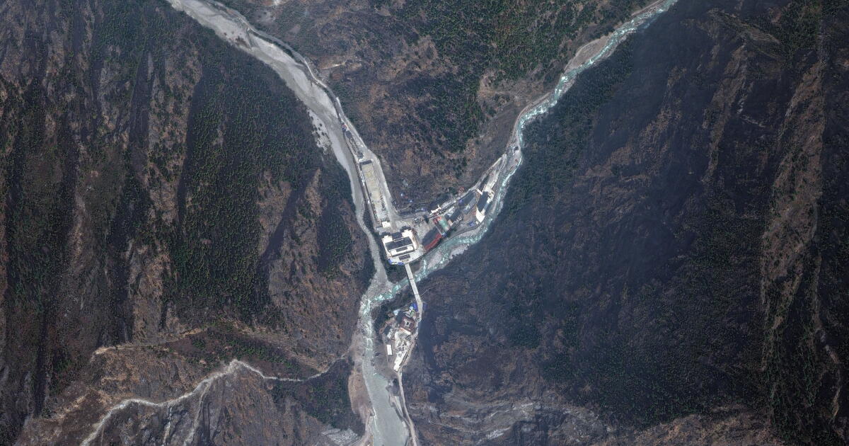
Catastrophic flash floods along the Nepal-China border have killed at least 353 people and left more than 1,300 missing, sweeping away villages, roads and hydropower facilities.
Authorities say people from more than 30 countries are unaccounted for, including hundreds of foreign tourists and Hindu pilgrims traveling to the sacred Mount Kailash region in Tibet.
New satellite images from Vantor Satellite Imagery show the shocking devastation along a roughly 10-mile swath of the Trishuli river stretching south from the northern border with China.
The steep slopes and lush valleys below the Himalayan mountain range — home to many of the world’s highest peaks and remaining glaciers — are especially vulnerable to flooding and landslides. Melting glaciers have become more common because of human-caused climate change.
The image below shows the Rasuwagadhi border post on the Nepal-China border, at left, on April 19, 2024 and, at right, on Thursday, after the devastating flood.
The entire structure appeared to have been wiped out by the flood, with hardly any evidence of what once existed at the border.
The deadly flash flood in Nepal on Wednesday likely was caused by a huge chunk of a glacier that broke off and temporarily dammed a river, according to preliminary investigations by scientists. That may have led to the backed-up water surging downstream with enormous force a few hours later, they suggested.
The image below shows a power plant and bridge less than a mile downriver from the border post before and after the flood.
The power plant was part of a network along the Trishuli river that provided about 10% of Nepal’s power production, the Associated Press reported.
India’s Ministry of External Affairs said Thursday that 288 of their nationals, including 73 workers on a power project, were missing. Additionally, South Korean government officials said nine citizens working on building a hydropower plant were missing.
Water levels in rivers across the flood-affected region rose by as much as 29½ feet in 30 minutes as a result of the surge from the glacial detachment upstream, researchers at the Kathmandu-based climate research group said.
The image below shows the Syapru Besi village 8½ miles downriver from the border post before and after the flood.
Much of the village was swept away in the surging floodwaters, with dozens of structures wiped off the map.
Rescuers found bodies in Chitwan district hundreds of miles downstream from the hardest-hit areas.
Bishal Kumar Bhandari, chairman of the Nepal Red Cross Society, said they have shifted their focus from rescue to large-scale relief operations in the flood-hit districts. He said that around 1,200 people were displaced from at least three villages.
The Associated Press contributed to this report.